


YORK - T 1 Voting District, Dane County, Wisconsin
About
Outline

Summary
| Unique Area Identifier | 692954 |
| Name | YORK - T 1 Voting District |
| County | Dane County |
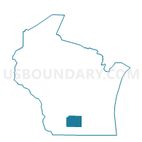
| State | Wisconsin |
| Area (square miles) | 35.85 |
| Land Area (square miles) | 35.80 |
| Water Area (square miles) | 0.05 |
| % of Land Area | 99.86 |
| % of Water Area | 0.14 |
| Latitude of the Internal Point | 43.24714090 |
| Longtitude of the Internal Point | -89.06074450 |
Maps


Graphs
Select a template below for downloading or customizing gragh for YORK - T 1 Voting District, Dane County, Wisconsin


Neighbors
Neighoring Voting District (by Name) Neighboring Voting District on the Map
- BRISTOL - T 1 Voting District, Dane County, WI
- COLUMBUS - T 1 Voting District, Columbia County, WI
- ELBA - T 2 Voting District, Dodge County, WI
- HAMPDEN - T 1 Voting District, Columbia County, WI
- MEDINA - T 1 Voting District, Dane County, WI
- PORTLAND - T 1 Voting District, Dodge County, WI
- SUN PRAIRIE - T 1 Voting District, Dane County, WI
- Waterloo - C 2 Voting District, Jefferson County, WI
Top 10 Neighboring County Subdivision (by Population) Neighboring County Subdivision on the Map
- Bristol town, Dane County, WI (3,765)
- Waterloo city, Jefferson County, WI (3,333)
- Sun Prairie town, Dane County, WI (2,326)
- Medina town, Dane County, WI (1,376)
- Portland town, Dodge County, WI (1,079)
- Elba town, Dodge County, WI (996)
- York town, Dane County, WI (652)
- Columbus town, Columbia County, WI (646)
- Hampden town, Columbia County, WI (574)
Top 10 Neighboring Place (by Population) Neighboring Place on the Map
Top 10 Neighboring Unified School District (by Population) Neighboring Unified School District on the Map
- Sun Prairie Area School District, WI (41,472)
- Columbus School District, WI (7,940)
- Marshall School District, WI (5,857)
- Waterloo School District, WI (5,415)
Top 10 Neighboring State Legislative District Lower Chamber (by Population) Neighboring State Legislative District Lower Chamber on the Map
- Assembly District 46, WI (65,837)
- Assembly District 47, WI (61,697)
- Assembly District 38, WI (59,797)
- Assembly District 37, WI (58,965)
Top 10 Neighboring State Legislative District Upper Chamber (by Population) Neighboring State Legislative District Upper Chamber on the Map
Top 10 Neighboring 111th Congressional District (by Population) Neighboring 111th Congressional District on the Map
Top 10 Neighboring Census Tract (by Population) Neighboring Census Tract on the Map
- Census Tract 118, Dane County, WI (5,890)
- Census Tract 1004, Jefferson County, WI (5,816)
- Census Tract 9712, Columbia County, WI (5,200)
- Census Tract 9618, Dodge County, WI (4,412)
- Census Tract 117, Dane County, WI (3,900)
- Census Tract 9711, Columbia County, WI (3,622)